Iceland Travel & Planning Guide

Volcanic Activity on the Reykjanes Peninsula & Visiting the Blue Lagoon Safely

What travelers need to know about seismic activity on the Reykjanes Peninsula near Grindavík and the Blue Lagoon, and how to monitor official safety alerts.

By: Camp Iceland Editorial Team Last Reviewed: April 1, 2026 ← All Travel Guides
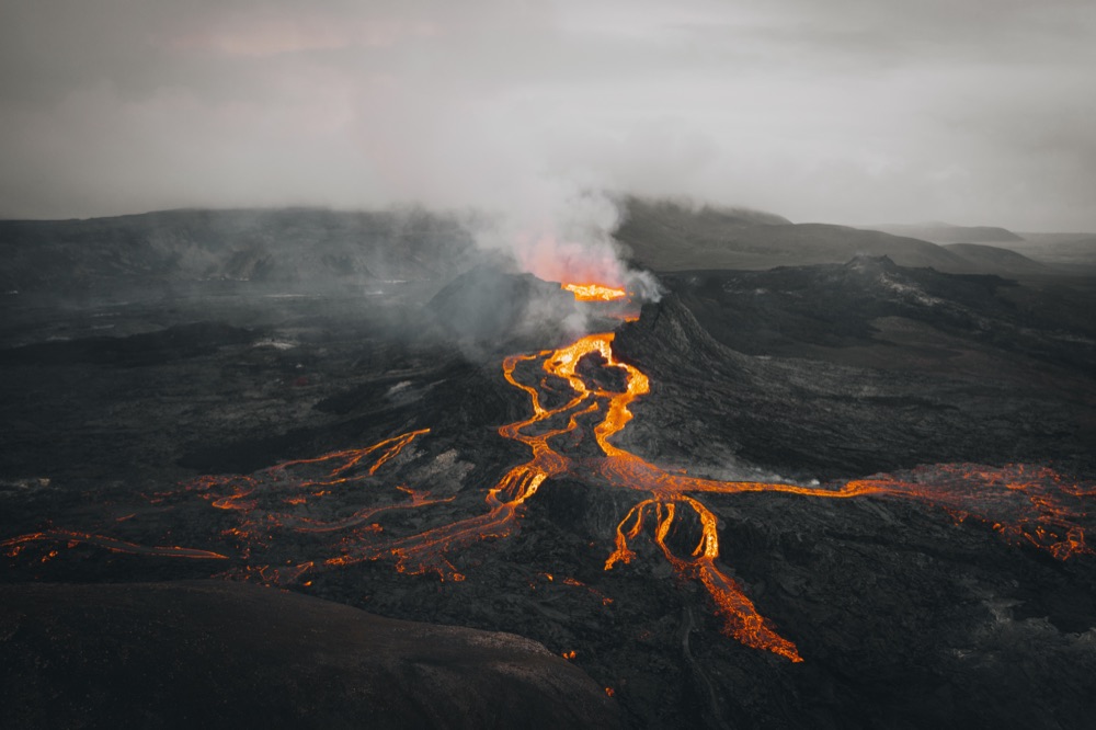
Aerial view of glowing lava streams and volcanic terrain on the Reykjanes Peninsula in Iceland

Since 2021, the Reykjanes Peninsula in southwest Iceland—initially along the Fagradalsfjall fissure system and more recently along the Sundhnúksgígar crater row near Grindavík and Svartsengi—has experienced periodic volcanic fissure eruptions and seismic swarms. Because Keflavík International Airport (KEF) and the Blue Lagoon sit on the Reykjanes Peninsula, here is what visitors need to know to travel safely.

1. Is Keflavík Airport & Ring Road Travel Affected?

  • Flights & Keflavík Airport: Recent Reykjanes eruptions have been effusive lava fissure eruptions rather than explosive ash-producing sub-glacial eruptions (like Eyjafjallajökull in 2010). Commercial flights at Keflavík Airport and travel along the Ring Road (Route 1) have continued to operate normally.
  • Localized Exclusion Zones: Whenever magma accumulation or an eruption occurs near Svartsengi or Grindavík, Icelandic Civil Protection immediately establishes localized road closures and earthen protective barriers around the affected zone.

2. Checking Blue Lagoon Operational Status

Because the Blue Lagoon is located at Svartsengi (approximately 4–5 km from the Sundhnúksgígar crater row), the facility closely coordinates with the Icelandic Met Office and Department of Civil Protection.

  • Before You Drive: Always check the official Blue Lagoon Operational Update page and umferdin.is (road.is) on the morning of your booking to confirm whether Route 43 (Grindavíkurvegur) is open.
  • Alternative Geothermal Lagoons Nearby: If the Blue Lagoon is temporarily closed due to seismic precautions during your visit, Sky Lagoon (in Kópavogur, 12 minutes from downtown Reykjavík) and Hvammsvík Hot Springs (in Hvalfjörður) remain completely unaffected. Compare all top lagoons in our Geothermal Lagoons & Activities Guide.

3. Official Volcanic & Weather Monitoring Resources

Never attempt to hike toward an active volcanic site unless an official trail has been declared open and marked by search-and-rescue teams (ICE-SAR):

  • en.vedur.is: Live seismic maps, gas dispersion forecasts, and volcanic hazard assessments from the Icelandic Met Office.
  • safetravel.is: Real-time traveler alerts and SMS safety notifications.
  • umferdin.is/en: Live road closures across the Reykjanes Peninsula and all of Iceland.
Recommended Local Partner via Go Car Rental Iceland

Compare 2WD Cars & F-Road Ready 4x4 SUVs for Your Iceland Drive

Check current rates, Gravel & Sand/Ash insurance options, and Keflavík Airport (KEF) pickup directly with Go Car Rental and Go Campers.

Live seasonal pricing, real-time vehicle or tour availability, and full booking terms are provided directly on the operator's website.

Recommended Self-Drive Fleet • Go Car Rental Iceland

Popular Rental Cars & 4x4 SUVs for Exploring Iceland

Compare economical 2WDs for summer paved roads and F-road-approved 4x4 SUVs for year-round driving.

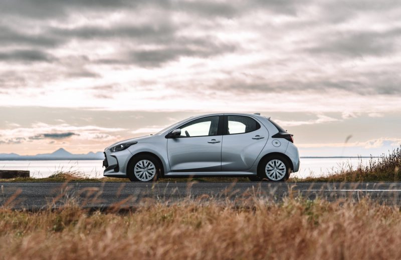
Toyota Yaris automatic compact rental car parked by the coast in Iceland
Go Car Rental Ring Road & Paved

Toyota Yaris (Automatic)

Economy 2WD • 2WD (Front-Wheel Drive)

⚙ Automatic 👥 5 Seats 🧳 2 Bags

Best for: Couples or solo travelers sticking to paved Route 1 (Ring Road), the Golden Circle, and the South Coast in summer.

  • Automatic transmission & low fuel consumption (~5.0L/100km)
  • Apple CarPlay / Android Auto & heated front seats
  • 24/7 Keflavík Airport (KEF) & Reykjavík pickup
Estimated Starting Rate
From $51/day · May–Sept Paved Ring Road
KEF / RVK
View Toyota Yaris & Rates
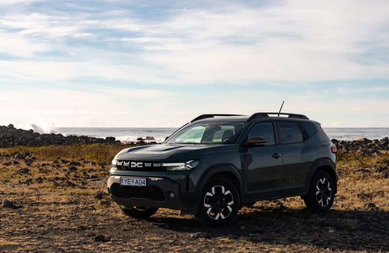
Dacia Duster 4x4 SUV parked on a rocky coastline in Iceland
Go Car Rental ✓ F-Road Approved

Dacia Duster 4x4

Value 4x4 SUV • 4x4 / All-Wheel Drive

⚙ Manual 👥 5 Seats 🧳 3–4 Bags

Best for: Iceland’s #1 value 4x4 for Kjölur (Route 35), Landmannalaugar (F208 North), Westfjords gravel passes, and winter roads.

  • Contractually F-road approved with selectable 4WD Lock mode
  • 210mm high ground clearance for gravel ruts and potholes
  • Fitted with studded winter tires free of charge Nov–Apr
Estimated Starting Rate
From $58/day · F-Road & Winter Ready
KEF / RVK
View Dacia Duster 4x4 & Rates
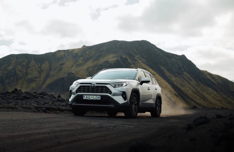
Toyota RAV4 4x4 automatic SUV driving on a volcanic gravel road in the Icelandic Highlands
Go Car Rental ✓ F-Road Approved

Toyota RAV4 4x4 (Automatic)

Mid-Size 4x4 SUV • 4x4 / All-Wheel Drive

⚙ Automatic 👥 5 Seats 🧳 4 Large Bags

Best for: The gold-standard 10–14 day Ring Road, Westfjords, and Highland SUV with generous luggage capacity and confident winter handling.

  • Spacious cabin & trunk for 4 adults with full luggage
  • F-road approved for Landmannalaugar (F208 North) & Kjölur
  • Excellent stability in coastal crosswinds and winter snow
Estimated Starting Rate
From $82/day · Top Ring Road & Highland SUV
KEF / RVK
View Toyota RAV4 4x4 & Rates

Reference daily starting rates reflect low/shoulder-season base estimates. Check live seasonal pricing, real-time fleet availability, and full insurance options directly on Go Car Rental and Go Campers.

Interactive Route Map • 16 Must-See Landmarks

Key Waterfalls, Glaciers, Canyons & Highland Stops

Click any pin on the map to view landmark photography, road access, and the nearest overnight campsite.

2WD / Paved Access 4x4 / Highland Track Route 1 (Ring Road) Highland F-Roads
Click any numbered pin on the map (16 plotted) to view photos, GPS & vehicle match
#1
66°N · ARCTIC COAST VATNAJÖKULL LANGJÖKULL HOFSJÖKULL WESTFJORDS SNÆFELLSNES NORTH ICELAND EASTFJORDS SOUTH COAST CENTRAL HIGHLANDS ✈ KEF 1 2 3 4 5 6 7 8 9 10 11 12 13 14 15 16 #1 Þingvellir National Park …
Almannagjá tectonic canyon and river at Þingvellir National Park
#1 · Golden Circle • Day 1 UNESCO Rift Valley

Þingvellir National Park & Silfra Fissure

📍 GPS: 64.2559° N, 21.1295° W 🚗 Paved Route 36 (2WD OK)

Walk between the North American and Eurasian tectonic plates where Iceland’s Alþingi parliament met in 930 AD. Allow 1.5–2 hours for the gorge walk and Öxarárfoss waterfall, or 3 hours if snorkeling Silfra.

⛺ Nearest Overnight Campsite: Þingvellir Leirar Campsite (On-site)
Continue Reading

Related Iceland Travel Guides